KAOSHIUNG/2005NANJING/2008
Nanjing Tangshan Urban Design: Landscape as Flow
Design Team:
Perry Yang, Dai Guowen, Zhang Zijun, Zhao Qian, Peggy Lu, Wu Hailong, Liang Jing, Li Chengxing
Collaborator:
Sun Yet-sen University: Yuan Qifeng Studio
Awards:
Final Entry
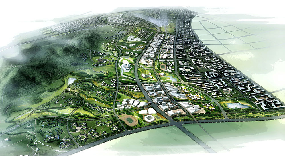
The Yangtz River Region has become one of the most influential city-regions in the process of China’s urbanization and globalization. Tanshan as a suburban setting represents an extension of Shanghai economic and forces and Nanjing’s cultural images to the deep inland area of the region, which would attract events and activities of metropolitan culture, creative industries, quality life, educational opportunities, recreation and tourism. The project raises a question ‘Whose Tangshan?’ and argues that Tanshan would be shaped as a pluralistic urban landscape for people of different background. Although Tanshan is known for being one of the four prestigious hot spring settings in China, the issue of exhausting natural resources has urged the planning to focus on natural conservation and restoration of landscape as the first priority.
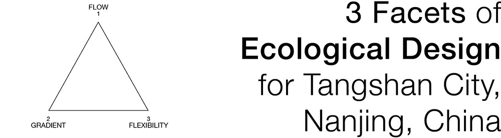
The project took flow, gradient and flexibility, as three major concepts to derive key design and development strategies. Three landscape ecological principles including landscape as flow, ecological gradient and landscape as process were applied to the analysis of Tanshan’s topographic feature. Different from most practices of China’s new town planning that emphasize functional planning, land use and the subdivision of ‘land parcel’, the project took the ‘landscape’ as the basic element and the flow, gradient and flexibility as the key principles to comprehend and organize the urban landscape patterns of Tanshan new town. The design responds to landscape urbanism, however, extending its ideas to the organization of urban form and structure of an entire new town and its design and development strategies. Most practices of the contemporary landscape urbanism in North America and Europe tend to deal with urban fringe and open space environment.
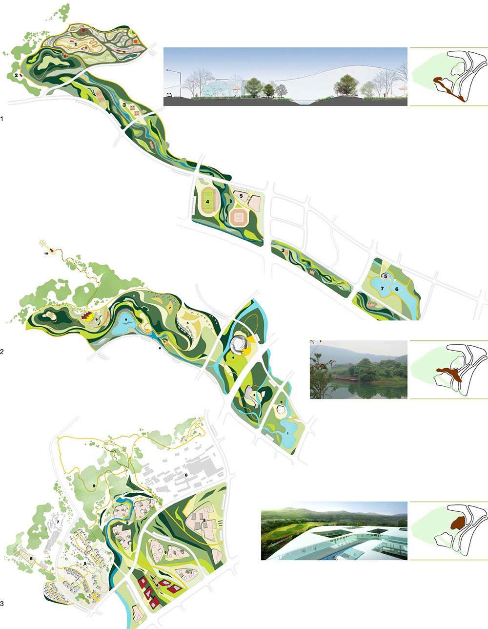
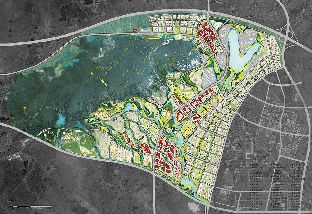
1. Flow: The project takes ‘landscape as flow’ as its design strategy to regenerate the hydrology and forest ecosystem. The terrain of Tangshan tilts from the higher north west to lower south east districts, which formulate undulating valley-like corridors to come with gentle hilly topography at both sides. The valley-like lower ground is composed of a series of linear spatial form, functioning as a dynamic wetland system that accommodates variation of runoff according different seasons. The design takes high lands as potential development parcels that are intertwined with valley-like undulating landscape and its ecology and hydrology. The programming strategy brings in entertainment, sport valley, spring valley and healthy valley that form a green and blue patterns of landscape flows moving down to residential districts at the downstream. The linear spatial structure provides sequential and transitional experiences when people move along the corridors from the city all the way up to the hill area.
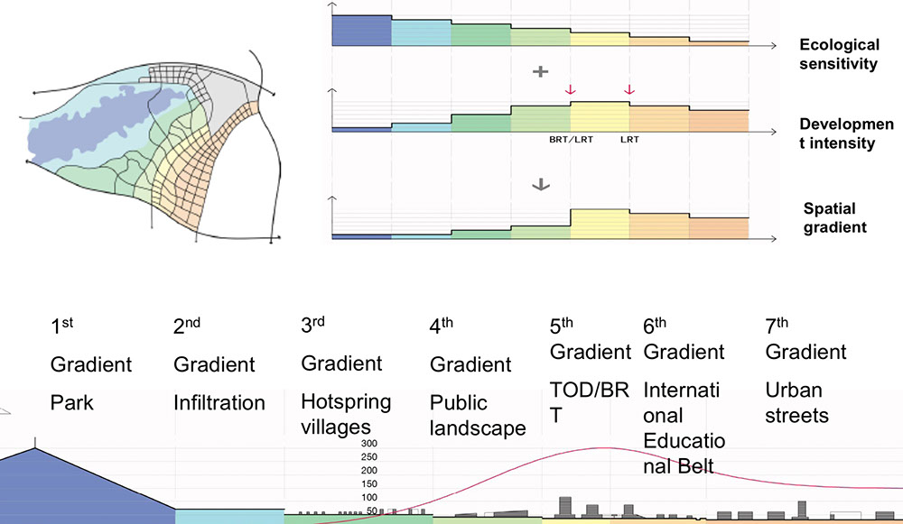
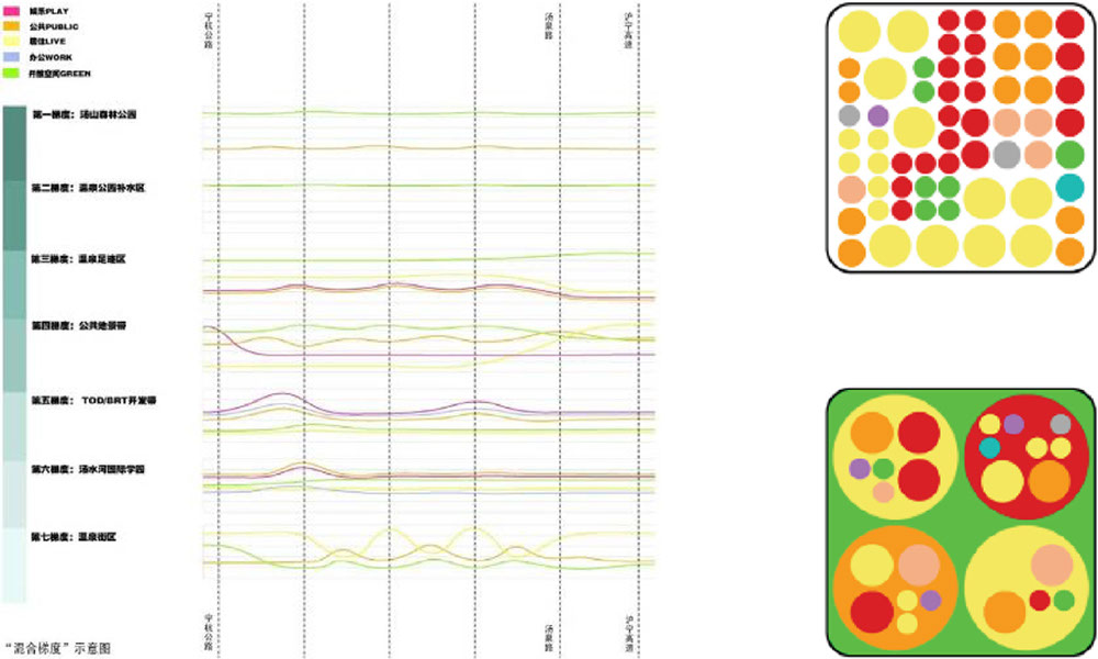
2. Gradient: The urban form of the ecological oriented city is structured based on the principle of ecological gradient. The intensity and typology of urban block is guided according to what ecological zones they are located. The first gradient of the ecological zones starts from the Tanshan Hill. There are seven degrees of ecological gradient that go down incrementally from Tanshan forest conservation zone, hot spring infiltration zone, hot spring recreational zone, public landscape zone, transit oriented development belt, educational development band and the eco urban blocks.
3. Flexibility: The new town development strategy emphasizes flexibility in mechanism and diversity in uses. The core district becomes a catalyst for stimulating the process, in which the urban structure of ecological gradient accommodates incremental growth. It is a flexible spatial framework that allows the project programming and spatial design to go in parallel to adapt to changing development pattern in market. The ecological control guidelines such as blue line and green line are determined as a planning outline. The idea of ‘land use diversity palette’ is applied to determine the intensity and diversity of land use following their guidelines in the respective ecological gradient zone, which is connected to a system of ecological performance evaluation. The concept of ‘landscape as flow’ is developed based on a legible ecological spatial structure and a pluralist cultural landscape which open varieties of opportunities in future.